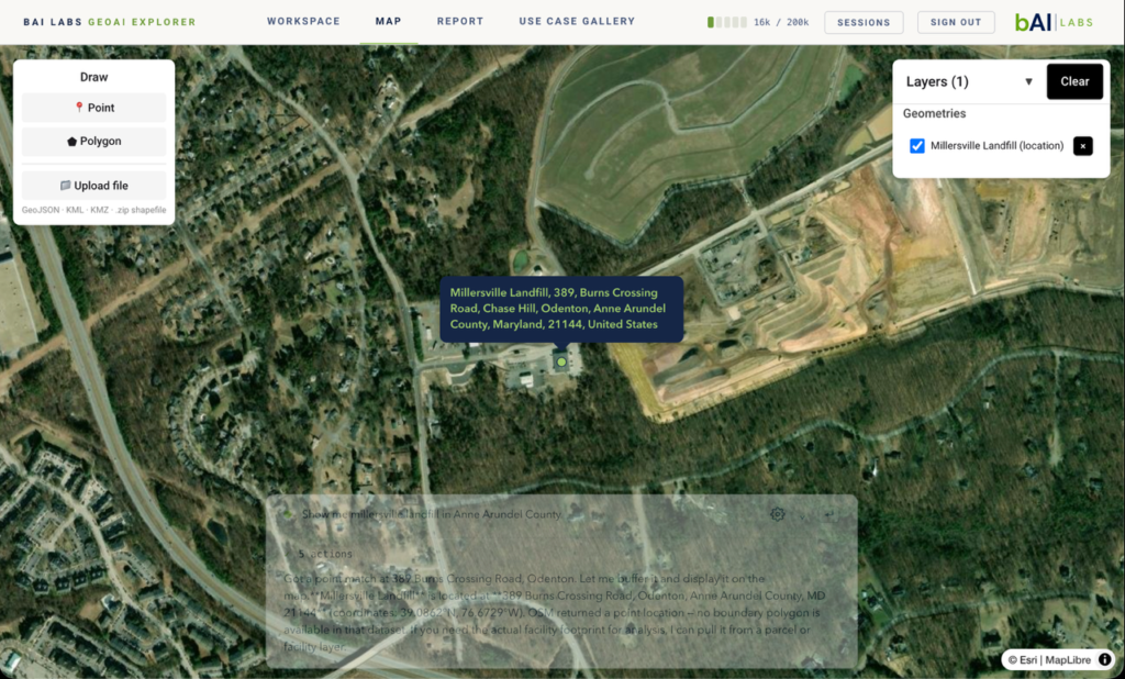
At bAI Labs, we feel incredibly fortunate to be working at the intersection of two exciting developments in geospatial artificial intelligence.
On one side, we have been collaborating with the OlmoEarth program at the Allen Institute for AI (Ai2) and partners to explore how one of the world’s leading open-source geospatial foundation models can help address real environmental engineering challenges. On the other, we have been developing GeoAI Explorer, our conversational geospatial platform designed to help engineers investigate complex environmental questions using authoritative public datasets, geospatial analysis, and artificial intelligence.
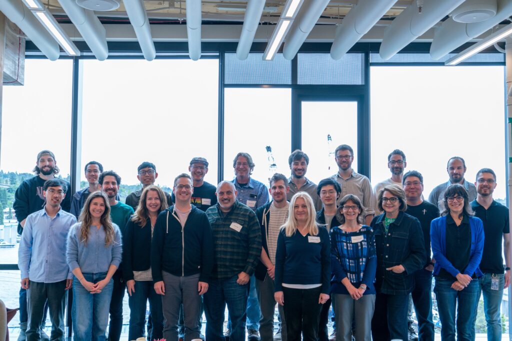
Although these efforts began independently, they now complement one another in meaningful ways.
One of the greatest strengths of the open-source ecosystem is that it allows organizations like ours to innovate from a strong scientific foundation rather than beginning from scratch. GeoAI Explorer has been built on open-source geospatial software, authoritative public datasets, and scalable cloud infrastructure. As participants in Ai2’s OlmoEarth Working Group, we are excited to incorporate OlmoEarth as one of the foundation models supporting GeoAI Explorer as the platform continues to evolve. This approach allows our team to spend less time recreating foundational AI capabilities and more time applying engineering expertise, scientific knowledge, and domain-specific workflows to solve practical civil and environmental engineering challenges.
Building on those advances, we have designed GeoAI Explorer around the needs of scientists and engineers. The platform combines conversational AI, geospatial workflows, authoritative environmental datasets, and engineering-focused analysis into a transparent decision-support environment. Depending on the task, GeoAI Explorer can leverage AI models, while adding the engineering context, scientific oversight, and traceability that practicing professionals require.
Our focus is on extending these advances into practical environmental engineering workflows. We believe the future of GeoAI will come from combining open scientific innovation with deep domain expertise, authoritative data, and responsible AI design to help practitioners make better-informed decisions.
That naturally raises an important question:
Can AI help civil and environmental engineers better understand watersheds, infrastructure, and natural systems while remaining transparent, scientifically grounded, and accountable?
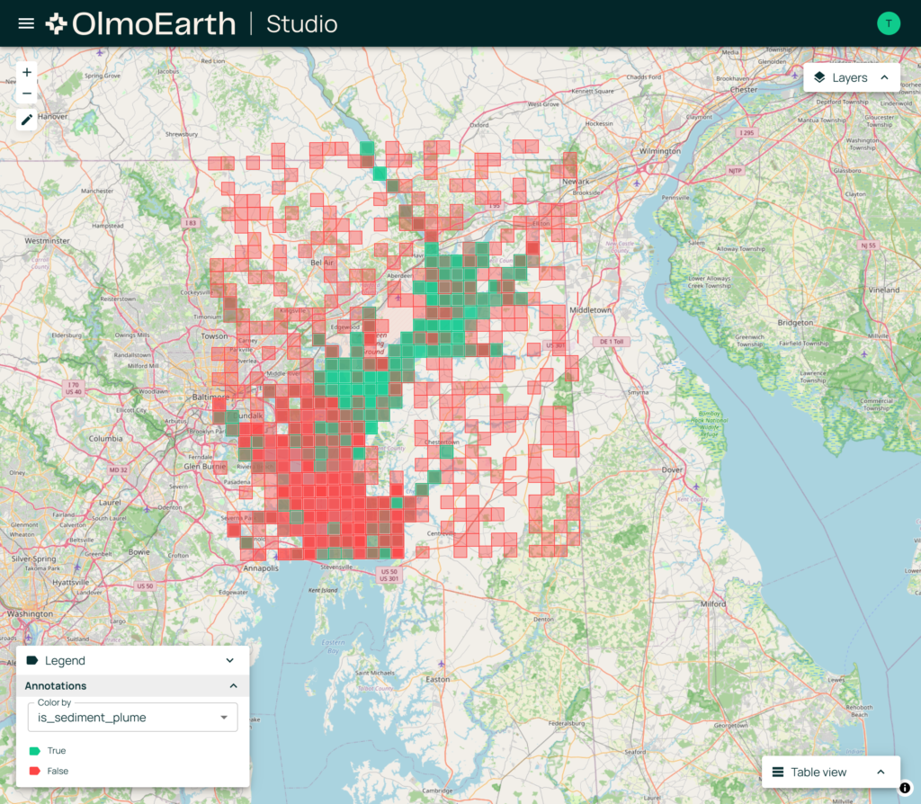
For example, through our ongoing case study using OlmoEarth, we are evaluating whether the model can recognize sediment plumes in the Upper Chesapeake Bay following a major Susquehanna River flow event using Sentinel-2 satellite imagery together with USGS streamflow data. The goal is to better understand where these emerging capabilities may assist environmental investigations.
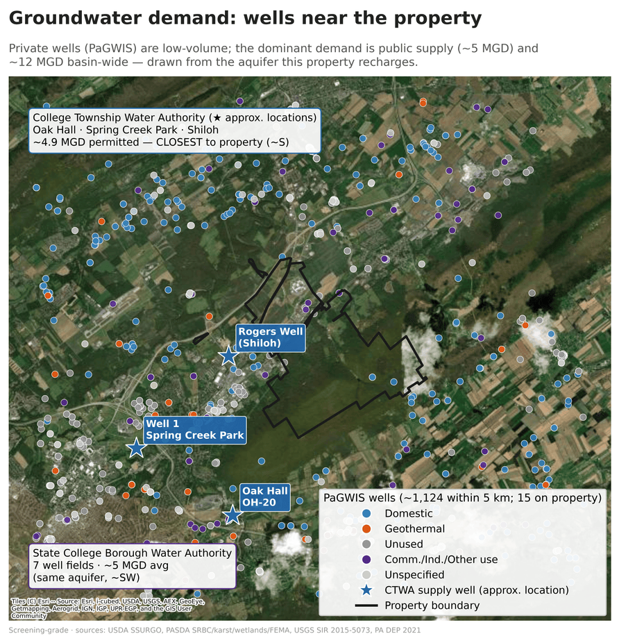
At the same time, our team has been advancing GeoAI Explorer through real-world engineering case studies. In a recent investigation within Pennsylvania’s Spring Creek watershed, our geologists and AI researchers worked together to evaluate groundwater recharge, karst geology, soils, streams, wetlands, wells, land cover, and future development scenarios using authoritative public datasets. Rather than relying on a single AI model, GeoAI Explorer orchestrated multiple geospatial workflows and datasets to support a structured screening-level investigation that remained grounded in scientific evidence.
These projects are different in scope, but together they illustrate where GeoAI may be heading. One explores how foundation models can better understand what they observe from satellite imagery. The other focuses on helping scientists and engineers interpret those observations within the broader context of geology, hydrology, land use, regulations, infrastructure, and environmental decision making.
Perhaps the most important lesson we have learned is that powerful AI models alone do not produce trustworthy engineering insights.
Meaningful environmental investigations require environmental scientists, geologists, engineers, and AI researchers working together throughout the analytical process. That philosophy is reflected in how we are designing GeoAI Explorer. We are intentionally building the platform around scientist-in-the-loop workflows, observability, and transparency so users can understand not only an answer, but how that answer was produced.
Our goal is for every meaningful result to be traceable back to the underlying data, analytical workflow, AI models involved, and supporting evidence. We are also exploring ways to provide greater visibility into model interactions, reasoning steps, and token usage so practitioners can better understand how AI contributes to an investigation rather than treating it as a black box. These capabilities are becoming increasingly important as AI begins supporting professional engineering workflows where accountability and documentation matter.
Ultimately, we hope tools like GeoAI Explorer will help environmental professionals spend less time locating, organizing, and preparing data, and more time evaluating complex environmental questions. Used responsibly, these technologies have the potential to support watershed planning, environmental due diligence, infrastructure management, natural resource assessments, and other screening-level analyses when paired with scientific expertise and professional judgment.
We remain early in this journey, and we are intentionally sharing what we are learning rather than claiming to have all the answers. Every pilot, every field investigation, and every collaboration helps us better understand both the opportunities and the limitations of GeoAI.